30.07.2023
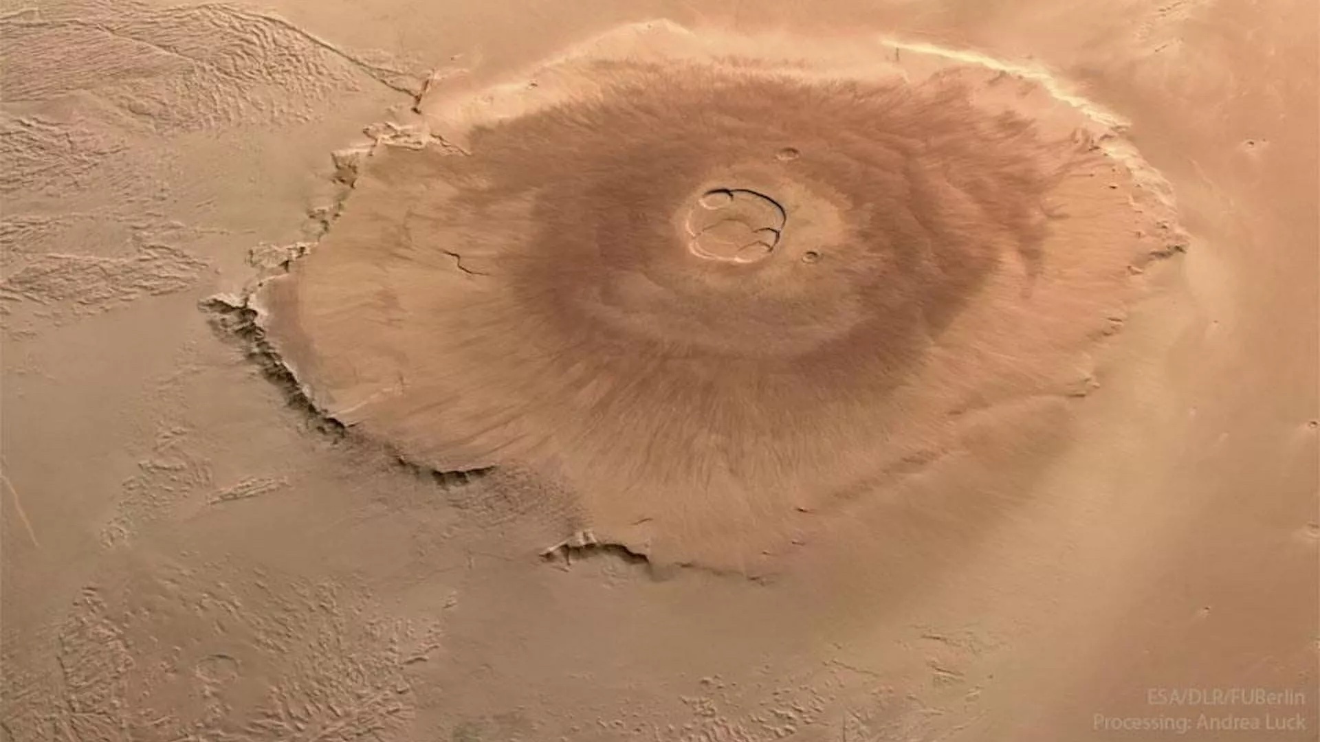
Giant cliffs that encircle Olympus Mons formed when lava flowing down the volcano encountered deep water.

Olympus Mons is the largest volcano in the solar system. (Image credit: ESA/DLR/FU Berlin/Mars Express/Andrea Luck CC BY 2.0)
The tallest mountain in the solar system has an interesting past.
Mars' mighty Olympus Mons may have once been a volcanic island surrounded by an ocean nearly 4 miles (6km) deep, according to geological evidence found in towering cliffs that ring the extinct volcano.
Olympus Mons is the tallest known mountain in the solar system, stretching 16 miles (25km) tall above the Martian surface, and with an enormous base about 374 miles (601km) wide. At the mountain's peak is a volcanic caldera that last erupted 25 million years ago. It sits next to the Tharsis Bulge – a huge volcanic plateau that features a row of three more shield volcanoes, Arsia, Pavonis and Ascraeus Mons.
A team led by Anthony Hildenbrand of Université Paris-Saclay in France has now published new work revealing that Olympus Mons displays similarities with volcanic islands on Earth, such as the Azores, the Canary Islands and the Hawaiian islands.
The evidence is in the form of giant cliffs, or escarpments, that climb nearly 4 miles (6 km) tall around Olympus Mons. Hildenbrand's team say the escarpments have the signature appearance of having formed where lava flowing down the flanks of the volcano encountered deep ocean water all around it. This would have taken place around 3.7 – 3.4 billion years ago.
While scientists have previously tried to connect the escarpments with liquid water, the exact relationship between them had not been clear until now.
If Hildenbrand's team is correct, then the top of the escarpments marks an ancient shoreline. Today, around Olympus Mons, we find a large depression in the surface, caused by the sheer weight of the mountain. The height of the escarpments indicates that ocean water would have filled in this depression to a depth of 4 miles (6 km).
Similar features are found on the northern flank of another Martian volcano, Alba Mons, which is located over 1,100 miles (1,800 km) away from Olympus Mons and indicates the possible extent of the ancient ocean.
The giant volcanoes of Mars would have formed over hot spots in the molten mantle, where convection causes warmer magma to rise in a giant plume. Rather than all the volcanoes in the region having formed from the same plume, Hildebrand told Space.com that "the most probable hypothesis is [that there were] distinct regional plumes under Olympus Mons and Alba Mons, separated at the surface by hundreds of kilometers."
These plumes caused the surface to bulge outwards over a large area. Today we call it the Tharsis Bulge – an enormous volcanic plateau. Hildebrand's team argues that the mantle uplift that powered the volcanoes had an even greater effect on the ocean around them, by deforming the planet's crust so much that it shifted the location of the ocean.

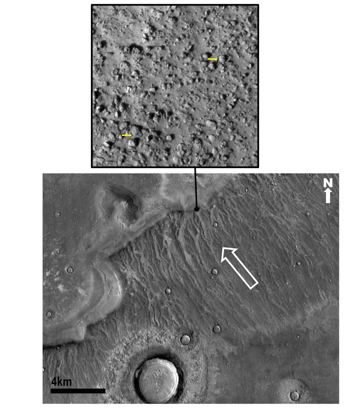
View of a boulder-rich surface deposited by the older tsunami. These were then eroded by channels produced as the tsunami water returned to the ocean elevation level (white arrow shows flow return direction). Yellow bars are 10 meters. (Image credit: NASA/Alexis Rodriguez
Previous studies have found evidence for two distinct shorelines within a lowland region on Mars called Vastitas Borealis. The shorelines differ in elevation by several miles. They had been interpreted as evidence for two different oceans that existed in Vastitas Borealis hundreds of millions of years apart.
However, Hildenbrand's team think that rather than there being multiple oceans, there was just one long-lasting ocean. As the mantle uplift pushed against the planet’s crust and formed the Tharsis Bulge, it deformed Mars’ surface enough to actually shift the location of the ocean, hence we see two shorelines separated in age.
"The youngest shorelines reported in previous studies could reflect the later stages of a main single ocean that was pushed to the west by a major surface uplift in the Tharsis area," said Hildebrand.
The findings provide planetary scientists with further details about the history of water on Mars. When the ocean shoreline shifted, it is thought that the ocean was already beginning to recede and dry up. If Mars were ever habitable, this era could have signaled the end of that habitability.
The research was published on July 24 in the journal Earth and Planetary Science Letters.
Quelle: SC
