29.10.2018

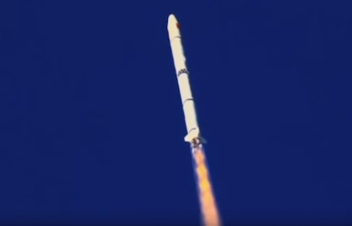
China launched a cooperative mission with the French agency CNES when the CFOSAT oceanographic satellite was lofted place from the Jiuquan Satellite Launching Center at 00:43 UTC Monday. A Long March-2C (Chang Zhen-2C) rocket was used to launch the new satellite together with several small satellites.
Developed jointly by the China National Space Administration (CNSA) and the Centre National d’Études Spatiales (CNES), CFOSAT carries two radar instruments. The SWIM (Surface Waves Investigation and Monitoring), is a wave scatterometer supplied by CNES and the SCAT (wind SCAT terometer), a wind-field scatterometer supplied by CNSA.
SWIM’s 6 rotating beams will enable it to measure wave properties (direction, wavelength, etc.), while SCAT will measure wind intensity and direction. The data will be downlinked to French and Chinese receiving stations.
These data will allow scientists to achieve more accurate ocean forecasts and give earlier warning of severe weather events like storms and cyclones. CFOSAT will also help climatologists to learn more about exchanges between the oceans and atmosphere, which play a key role in climate.
Conceived by the LATMOS atmospheres, environments and space observations laboratory in Paris and Guyancourt, the SWIM instrument was developed by Thales Alenia Space with oversight and funding from CNES. Other mission partners include the French Institute of marine research and exploration IFREMER, the French national weather service Meteo-France, and SHOM, the French naval hydrographic and oceanographic office.
Both instruments are Ku-band radars (13.2 to 13.6 GHz) scanning around the vertical axis. SWIM is a 6-beam radar at small incidence (0 to 10°), SCAT is a rotating fan-beam radar with larger incidence angles (18~50°). This combination of incidence angles is necessary to measure the wind vector (from large incidence) and wave properties (from small incidence).

CFOSAT in action – via CNES
The interest for the combination of the two payloads is evident since surface wind is the energy source which creates the surface waves; the space and time evolution of these surface waves is dependent on both local and remote wind conditions. The combination of the two instruments will help to separate the different effects governing the evolution of the wave field.
CFOSAT is a pre-operational mission of joint measurements of winds and waves which aims is to supply wind/wave observations in near-real time to the meteorological agencies to improve their forecast and sea state models. These measurements will also be supplied to the scientific community for the oceanographic and climate research to improve sea models as well as our understanding of the influence of the sea state on surface fluxes.
Operating at an altitude of 519 km, CFOSAT’s data availability will be in near-real time (less than three hours after acquisition) for the meteorological agencies. Data distribution will be made on request through a server and an authentication for the scientists, and systematically through meteorological servers for the meteorological agencies. The satellite will have a global coverage at a 13-day scale for SWIM and at a 3-day scale for SCAT.
CFOSAT is based on the CAST2000 satellite bus provided by the DFH Satellite Corp. The spacecraft has a launch mass of 600 kg and the primary structure has a size of 1.4 m x 1.4 m x 1.2 m. Mission design life is 3 years.
These main objectives are the modeling and prediction of ocean surface wind and waves; to determine the physical processes of wind and waves; to determine the interactions between surface waves, atmosphere and ocean; to investigate the interactions between electromagnetic signals and the ocean surface; and to study the wave evolution in coastal regions.
The requirements for the two payloads on CFOSAT are to estimate directional spectra of ocean waves along the satellite track at scales ranging from 50 x 50 km² to 70 x 70 km²; to transmit data in near real-time within 3 hours after acquisition; to estimate wind speed and significant wave height from nadir-looking beam, in a way similar to altimeter missions, and to estimate the wind vector over a swath of about 900 km with a nominal resolution of 50 x 50 km² (goal 25 x 25 km²); to sample spectral wave properties with a global coverage at a temporal scale of 10 to 15 days; and to sample wind with a global coverage at a temporal scale of 1 to 2 days.
The accuracy for wave estimates is of a minimum detectable wavelength of about 70 m, maximum detectable wavelength about 500 m, accuracy in wave propagation direction of about 15°, accuracy in wavelength of 10 to 20%, accuracy in significant wave height of 10% or better than 40-50 cm (TBC); the accuracy on wind speed estimates of ±2 m/s or 10% (whichever is larger) and on wind direction of ±20° in the range 4-24 m/s.
